Congratulations to our Executive Director, Emad Habib, for receiving the award for 'Outstanding Achievement in Exter
Civil Engineering Professor, Dr. Emad Habib, Leads Workshops on Flood Risk Information
Wed, 05/25/2022 - 12:00am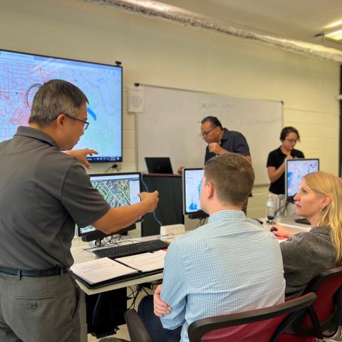
The University of Louisiana at Lafayette’s Civil Engineering department has been working on an interdisciplinary project to improve community engagement in flood mitigation using science-based tools. The National Science Foundation’s Smart and Connected Communities program awarded a planning grant last year to the University.
Dr. Habib, Civil Engineering Professor and Director of UL Lafayette Watershed Flood Center, emphasized that these efforts aim to not only provide information but help support all stakeholders in flood-prone communities such as ours. “We want the public to be knowledgeable about their flood risk, have a better dialogue as a community about the source of flooding and possible solutions, and be able to make more informed decisions as individuals and the community as a whole. This project will allow us as engineers to work with social scientists, planners, and policy experts when developing effective solutions for the community,” said Habib.
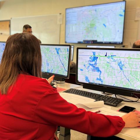
The project team, which includes multiple research units from UL Lafayette Civil Engineering, LA Watershed Flood Center, Blanco Public Policy Center, and UL Lafayette History Department, ran hydraulic models to generate flood maps and intersected them with buildings and roads to develop preliminary tools and apps that communicate the effects of floods.People learning at the workshop
Currently, the apps can illustrate the impact on drivability and accessibility and even estimate flood damages for specific buildings and structures. Being able to identify and predict the flood risk for individuals and the community can improve our response to storms and aid in planning for development and economic growth.
Three workshops were held recently with leaders from watershed and planning organizations, news media representatives, and officials from local parish and municipalities to receive feedback on the University’s tools and how they can be improved to address the community's needs.
Attendees evaluated the preliminary apps, compared existing flood risk tools and features, and recommended metrics to capture. Also discussed were challenges and suggestions for effectively communicating flood risk in ways that resonate with different groups.
Next steps for the UL Lafayette team include applying for a full research grant and further developing the tools that help users answer, “What does this flood mean for my own home, neighborhood, and community?”